August 20, 2015By: Newswire
 |
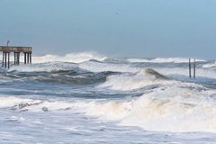
| Photo by Freeimages.com/Jeff Jones |
AccuWeather.com reports Danny became the first hurricane of the 2015 Atlantic season this week and is on track to bring drenching rain to part of the northern Caribbean islands next week.
Danny follows Ana, Bill and Claudette from earlier this season. None of the first three storms reached hurricane status.
The system became a tropical depression on Tuesday morning, a tropical storm on Tuesday afternoon then a hurricane during Thursday morning, local time. Danny will continue to move through generally favorable atmospheric conditions into this weekend, before reaching the Caribbean.
According to AccuWeather, when sustained winds around the center of circulation reach 39 mph, a tropical depression is upgraded to a tropical storm. For a system to become a hurricane, sustained winds must reach 74 mph. The system is moving west-northwestward over the south-central Atlantic Ocean at 10-15 mph (15-25 kph) this week.
As of Tuesday midday, Danny is currently about 1,100 miles east of Leeward islands and 900 miles north of the equator. According to AccuWeather Hurricane Expert Dan Kottlowski, fluctuations in strength are likely through the time it reaches the Leeward Islands by Monday.
Visit www.accuweather.com
What do you think of this $type?


