This post may contain affiliate links. We may earn money or products from the highlighted keywords or companies or banners mentioned in this post.
September 1, 2015By: Joe Pike
 |
| Photo by Freeimages.com/Jeff Jones |
According to a statement issued by the Hawaii Tourism Authority (HTA), minimal impacts are expected as Hurricane Ignacio continues on its path northwest of the Hawaiian Islands.
As of 5 a.m., Ignacio was located 335 miles east of Hana as a category 2 hurricane and is expected to continue to weaken due to increasing wind shear and become a tropical storm by Wednesday.
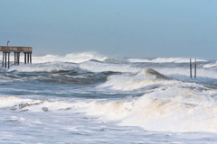
There are currently no tropical storm watches in effect for the state. The potential impacts of the passing storm include breezy to gusty wind conditions, high surf statewide through Tuesday, and heavy rainfall through Wednesday, according to the HTA.
This will be the final update form the HTA regarding Hurricane Ignacio; however, it is monitoring Hurricane Jimena and will provide updates if necessary.
According to Hawaii News Now, Jimena has lost some strength, but remains a major Category 4 hurricane in the east Pacific, well behind Hurricane Ignacio.
The National Hurricane Center said at 11 p.m. Monday, Jimena was located about 1,075 miles east of Hilo and was moving to the west at 13 miles per hour, according to Hawaii News Now. Forecasters say the hurricane will enter the Central Pacific sometime on Tuesday.
Jimena had maximum sustained winds of 130 miles per hour with higher gusts. It will likely maintain its strength over the next day or so, before it slowly weakens over open water, according to Hawaii News Now.
Visit www.hawaiitourismauthority.org/news/special-alert and keep visiting www.travelagentcentral.com for more updates on this story. Be sure to follow Travel Agent’s Joe Pike on Twitter @TravelPike.
What do you think of this $type?


